
Shoreline Mapping
COASTAL CHANGE NEAR BARROW IS BEING STUDIED AND MONITORED BY THE BAID TEAM USING A TWO-FOLD APPROACH
Recent changes — since 2002 — are being investigated with:
- DGPS surveys of the coastline once per year (or more frequently)
- Analysis of areal and volumetric loss due to coastal erosion
- Statistical evaluation of environmental controls on erosion
- Time-lapse video (see below)
- Near shore bathymetry surveys and more
Longer-term changes – since 1955 – are being quantified through:
- Processing of high-resolution historical imagery
- Digitizing waterlines for multiple “time slices” (such as 1955, 1979, 2002, and 2010-2014)
- Analysis of long-term erosion rates as they vary both across the area and through time.
EXTENSION SURVEYS WERE CONDUCTED IN THE 2015 FIELD SEASON. WE CONTINUE TO TARGET SENSITIVE AREAS VIA ANNUAL SURVEYS
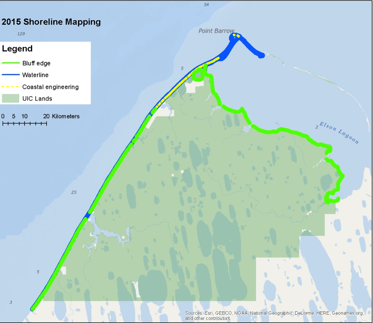

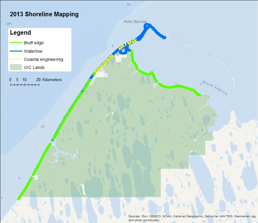
Shorelines, erosion rates, and a time series of imagery are included in the Coastal Erosion Viewer providing tools for researchers and community members to interactively visualize synthesized results, trends and implications.
Innovative Technology
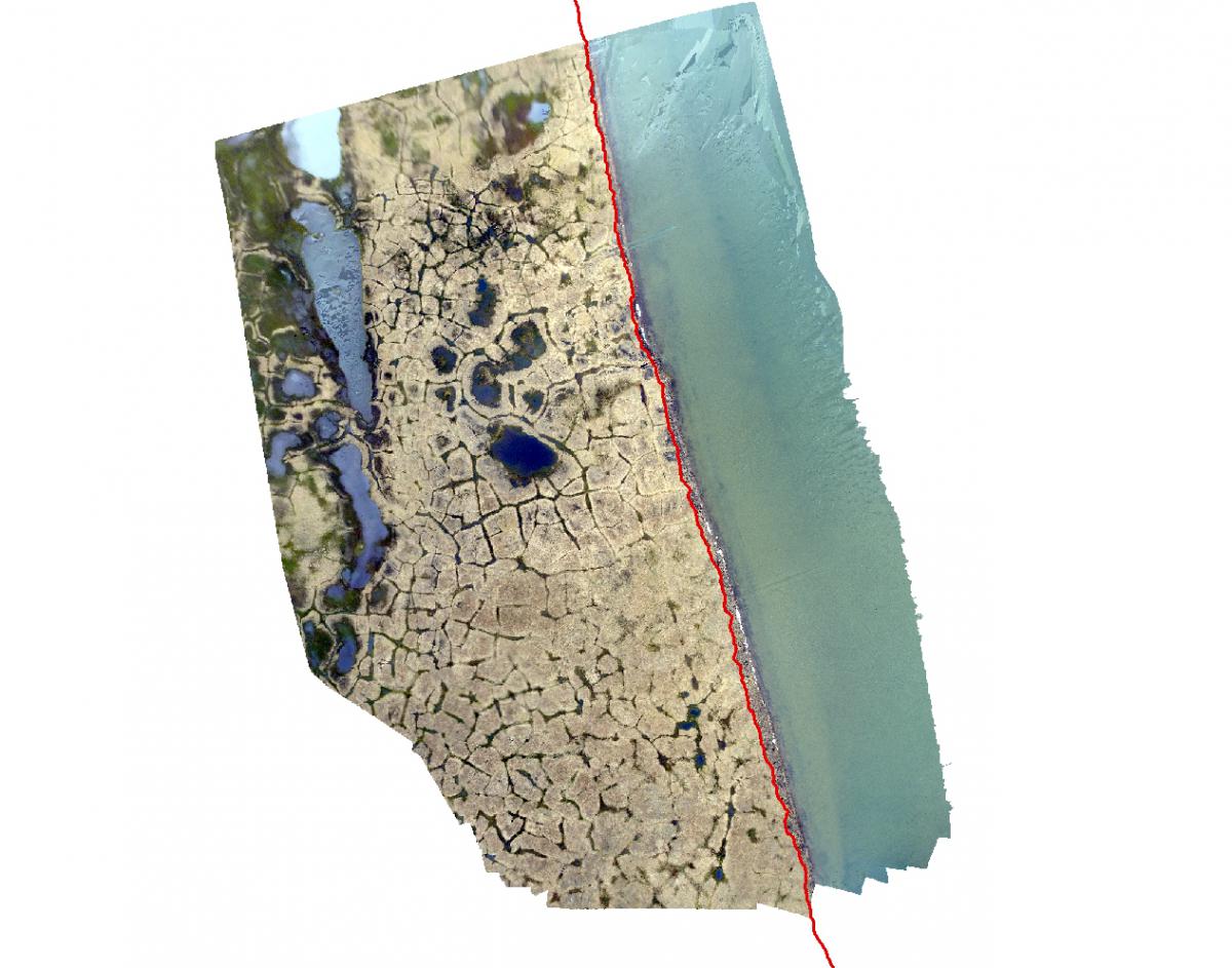
The BAID team has been working with kite and drone mounted camera systems as a low cost means for conducting repeat surveys. Aerial mosaics and Digital Elevation Models (DEM) can be created from these platforms. The aerial mosaic below was captured with a kite based system flown along Elson Lagoon in August, 2014. The imagery was processed with DGPS ground control points using Agisoft PhotoScan.
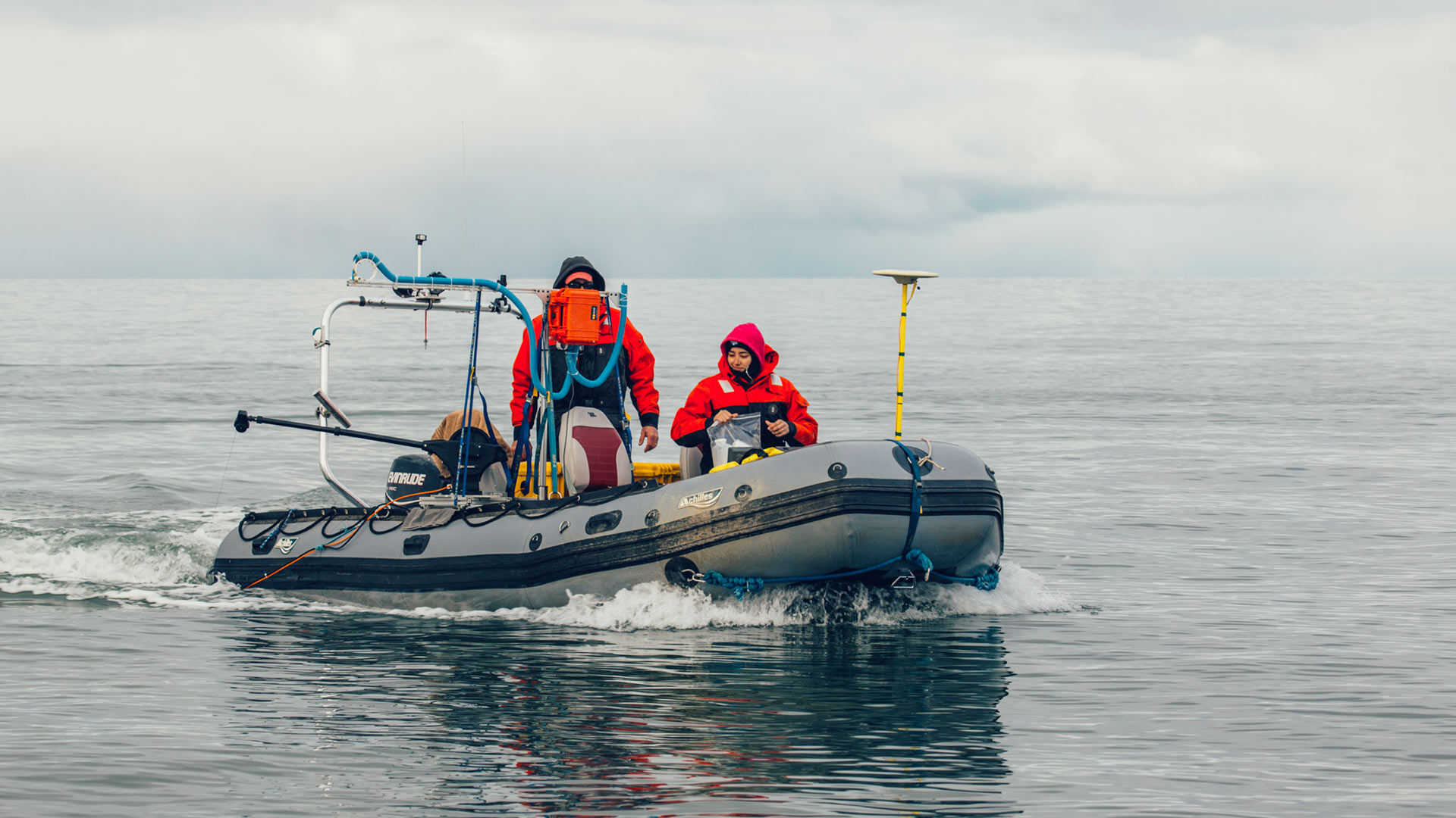
Near Shore Bathymetry
The BAID CIAP team has been testing a Survey-Grade Sonar mounted on a zodiak in Elson Lagoon. Extensive nearshore surveys are planned for the 2015 field season. Preliminary information was processed for the entire Elson Lagoon.
Local Expertise & Capacity
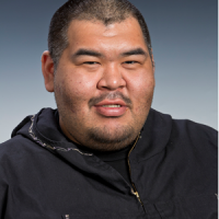
One of the goals of the BAID CIAP project is to build local GIS Capacity. Qaiyaan Aiken joined the BAID team in 2013 as a GIS technician based in Barrow with the UIC Science Division. Qaiyaan brings a unique combination of local knowledge and technical expertise to the project. Qaiyaan is trained in GIS and Differential GPS technology. He is an invaluable resource for conducting field work in the Arctic environment where his years of experience as an avid subsistence hunter are brought to bear in aiding the BAID team with data collection.
One of the goals of the BAID CIAP project is to build local GIS Capacity. Qaiyaan Aiken joined the BAID team in 2013 as a GIS technician based in Barrow with the UIC Science Division. Qaiyaan brings a unique combination of local knowledge and technical expertise to the project. Qaiyaan is trained in GIS and Differential GPS technology. He is an invaluable resource for conducting field work in the Arctic environment where his years of experience as an avid subsistence hunter are brought to bear in aiding the BAID team with data collection.
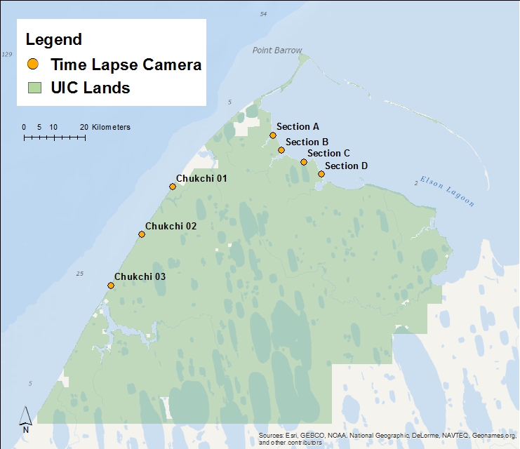
Coastal Cameras
Coastal Monitoring Viewer
